Die einzelnen Etappen unserer Expedition
| Datum | Ankunft | Ort | Strecke | Aktivitäten | Koordinaten |
|---|---|---|---|---|---|
| 19.02. | 20:00 | Ushuaia | Abfahrt | 54° 48' 36" S 68° 18' 1" W | |
| 20.02. | reiner Seetag in Richtung Süden | ||||
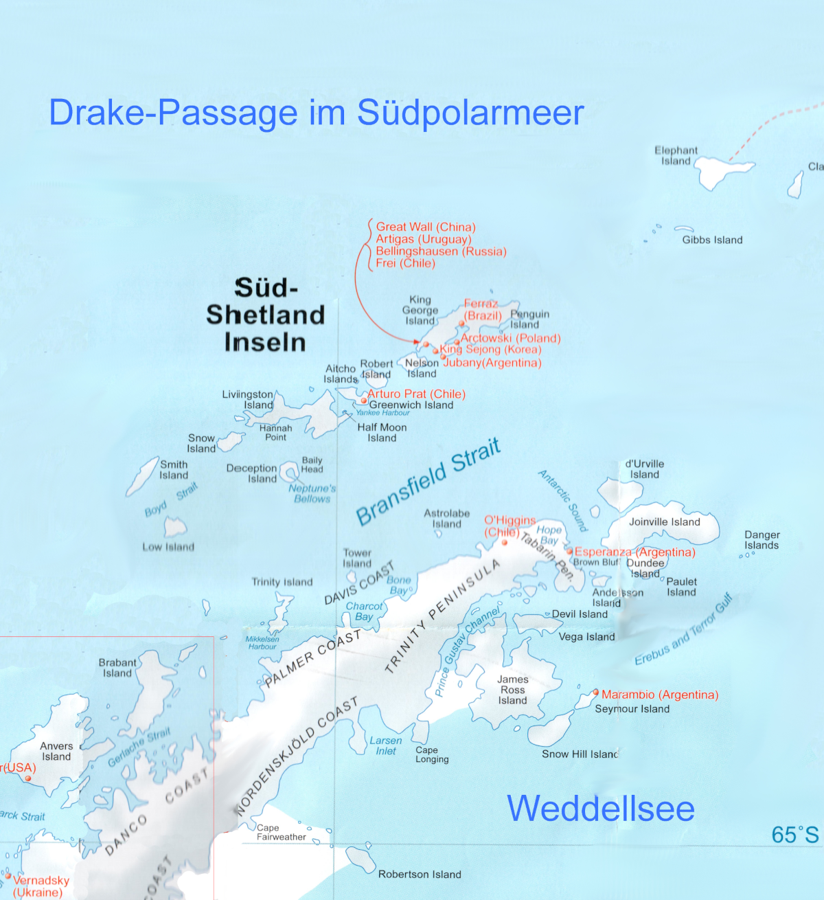
| 21.02. | 16:00 | Melchior Islands | 626 nm | Zodiacfahrt ohne Anlandung | 64° 19' 7" S 62° 58' 32" W |
| 22.02. | 10:00 | Cuverville Island | 76 nm | Zodiacfahrt, 1. Anlandung | 64° 40' 28" S 62° 36' 42" W |
| 22.02. | 14:00 | Neko Harbour | 15 nm | Zodiacfahrt, 2. Anlandung, erstes Mal auf Festland | 64° 50' 28" S 62° 32' 35" W |
| 23.02. | 10:00 | Paradise Bay | 66 nm | Zodiacfahrt ohne Anlandung | 64° 52' 49" S 62° 53' 22" W |
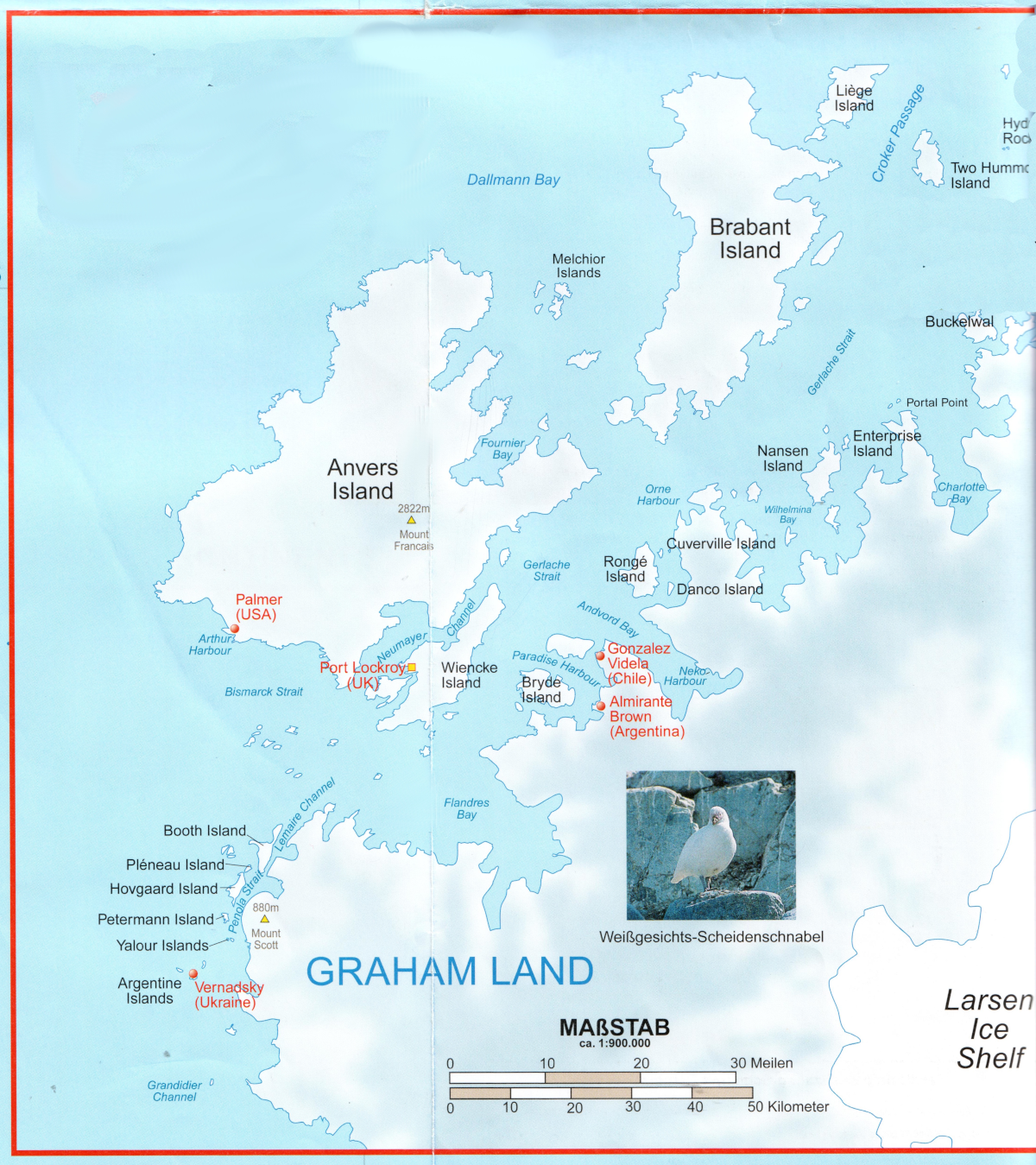
| 23.02. | 15:00 | Lemaire-Kanal | - | - | - |
| 23.02. | 17:00 | Petermann Island | 39 nm | Zodiacfahrt, 3. Anlandung | 65° 10' S 64° 10' W |
| 24.02. | 09:00 | Orne Harbour | 88 nm | Zodiacfahrt, 4. Anlandung, zweites Mal auf Festland | 64° 38' 0" S 62° 33' 0" W |
| 24.02. | 12:00 | Gerlach-Straße und Neumayer-Kanal | - | - | - |
| 24.02. | 15:00 | Dorian Bay | 29 nm | Zodiacfahrt, 5. Anlandung | 64° 48' 51" S 63° 29' 58" W |
| 25.02. | 10:00 | Deception Island | 154 nm | Zodiacfahrt, 6. Anlandung | 62° 59' 1" S 60° 33' 41" W |
| 25.02. | 16:00 | Half Moon Bay | 43 nm | Zodiacfahrt, 7. Anlandung | 62° 35' 24" S 59° 54' 4" W |
| 26.02. | 08:00 | Paulet Island | 138 nm | Zodiacfahrt, 8. Anlandung | 63° 34' 14" S 55° 47' 24" W |
| 26.02. | 12:00 | Weddellsee | - | - | - |
| 26.02. | 18:00 | Brown Bluff | 54 nm | Zodiacfahrt, 9. Anlandung, drittes Mal auf Festland | 63° 30' 56" S 56° 52' 12" W |
| 27.02. | 11:00 | Elephant Island | 178 nm | Zodiacfahrt ohne Anlandung | 61° 5' 46" S 54° 52' 6" W |
| 28.02. | 09:00 | Coronation Island (Shingle Cove) Süd-Orkney-Inseln | 280 nm | Zodiacfahrt, 10. Anlandung | 60° 39' 7" S 45° 32' 57" W |
| 01.03. | reiner Seetag in Richtung Südgeorgien | ||||
| 02.03. | 09:00 | Cooper Bay | Windstärke 8 - 10 Anlandung unmöglich | 54° 47' 10" S 35° 48' 49" W | |
| 02.03. | 11:00 | Gold Harbour | 525 nm | Zodiacfahrt, 11. Anlandung | 54° 37' 46" S 35° 54' 58" W |
| 02.03. | 17:00 | St. Andrews Bay | starke adiabatische Winde Anlandung unmöglich | 54° 26' 15" S 36° 10' 1" W | |
| 02.03. | 18:00 | Cumberland East Bay mit NordenskjöldGletscher | - | - | 54° 21' 16" S 36° 22' 6" W |
| 03.03. | 07:00 | Fortuna Bay | 173 nm | Zodiacfahrt, 12. Anlandung | 54° 9' 3" S 36° 48' 10" W |
| 03.03. | 14:00 | Grytviken | 25 nm | Zodiacfahrt, 13. Anlandung | 54° 17' 13" S 36° 29' 0" W |
| 04.03. | reiner Seetag in Richtung Montevideo | ||||
| 05.03. | reiner Seetag in Richtung Montevideo | ||||
| 06.03. | reiner Seetag in Richtung Montevideo | ||||
| 07.03. | reiner Seetag in Richtung Montevideo | ||||
| 08.03. | 07:00 | Montevideo, Uruguay | 1.450 nm | - | 34° 52' 38" S 56° 13' 10" W |
| Gesamt | 3.959 nm | = 7.332 km | |||
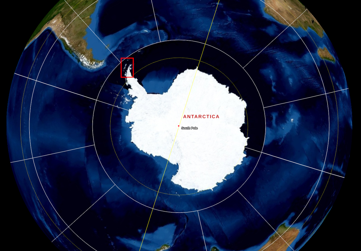
Karten zu unserer Expedition